I've received many emails asking me about the locations of many of my photos. Well, I don't mind letting people know. By far, my favorite aspect of photography is the locations of the photos themselves. Before I started doing photography in Feb, 2000, I was out there hiking and exploring the deserts. My main reason for going out to those remote locations was really very simple: escape. I felt and still feel the need to get away from everything that is familiar to me and explore that which is not.
When I'm not out on location, I can still view these areas in 3D perspective using Google Earth. Download the software, there is a trial version, and fly to where ever you want. You can fly over terrain in 3D, and many areas are displayed in high-resolution color imagery, with more areas being added all the time. You can tilt the image in 3D and see what the surrounding terrain looks like from the tops of mountains, or see how tall the mountains look from the valley areas. So not only can I show the location of a photo, I can show the angle at which it was taken. I would highly recommend checking this software out!
Another way to view these locations is via Terraserver. Terraserver is web-based and requires no download. It will display 95% of the united states in high resolution black and white images, but only from directly above. You can't fly, tilt, or see the images in 3D perspective. But it's still an excellent way to view locations, and it currently has much more high-resolution imagery than Google Earth.
Below are some of my favorite shooting locations.. Click on the corresponding "Google Earth" link (once you've downloaded and installed the software) or the "Terraserver" link to see where each area is located. If you're using Google Earth, be sure that "Terrain" (in the lower left of the screen) is turned ON.
Salton Sea: Google Earth Terraserver
Mormon Rocks: Google Earth Terraserver
Box Canyon: Google Earth Terraserver
Fish Creek, Anza Borrego Desert State Park: Google Earth Terraserver
Algodones Dunes: Google Earth Terraserver
Pinnacles National Natural Landmark: Google Earth Terraserver
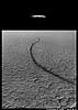
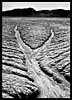
Dry lakes:
El Mirage Dry Lake: Google Earth Terraserver
Harper Dry Lake: Google Earth Terraserver
Galway Dry Lake: Google Earth Terraserver
Bristol Dry Lake: Google Earth Terraserver
Coyote Dry Lake: Google Earth Terraserver
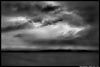
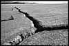
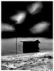
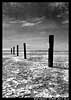
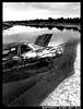
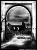
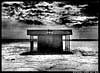
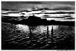
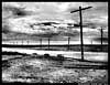
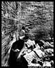
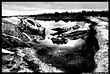
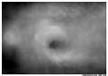
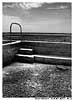
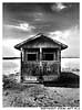
Now let's get a little more specific. Below you can see thumbnails of a number of my photos. Click on the left side of each image to see the location via Google Earth and on the right side of each image to see the location via Terraserver. In some cases, Google Earth will show you nothing but blurry ground and the skyline in the distance. This is because I'm trying to give you the exact location of the shot, I'm zoomed way in, and the data is not high-res. Just zoom out to see the location with more detail. It will be up to you to find the directions to the spot by turning "roads" on if using Google Earth, or compare the aerial photo to the topo maps if using Terraserver.
If using Google Earth, be sure terrain is turned ON!
You can also see some locations via Panoramio.